4 Best Hikes in Lake Clark National Park & Preserve
Four maintained Port Alsworth hikes to a beaver pond, Tanalian Falls, Kontrashibuna Lake, and Tanalian Mountain, with reviewed maps and elevation profiles.
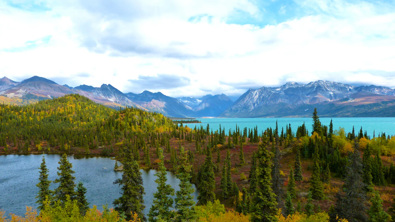
Lake Clark's most practical trailhead is reached by airplane, then on foot. Port Alsworth has no road connection and no grocery store. It does have a summer visitor center, two active gravel runways, and one compact trail system that climbs from town toward Tanalian Falls, Kontrashibuna Lake, and Tanalian Mountain.
Four hikes fit this network without padding the list with remote bushwhacks. Beaver Pond is the gentlest loop. Tanalian Falls is the usual half-day destination. Kontrashibuna Lake adds a quieter wilderness finish, while Tanalian Mountain turns the same opening miles into a hard summit day.
Distances need a little honesty here. NPS lists 3.2, about 4, about 5.5, and 8.6 miles for the four outings. Our reviewed tracks are roughly 3.5, 4.4, 6.6, and 9.6 miles because recorded start points and connectors differ. Treat the figures as planning ranges, then use the current trail map from the visitor center.
What changes a hiking day here
Build the hike around the flight
Most visitors fly from Anchorage, Homer, or the Kenai area, usually for about one to one and a half hours. Weather can delay either leg. Leave slack before the return flight and carry the layer, food, medication, and communications needed if the schedule moves.
Cross the runways at their ends
Walking through Port Alsworth may require crossing one or both active gravel runways. Go to the very end, then look left, right, and up. A small aircraft can be surprisingly quiet. The summer visitor center sits midway up the eastern runway and provides current trail information.
Carry bear spray where it can be reached
Brown and black bears use the park. Make normal human noise in brush and beside loud water, keep the group close, and move away if a bear has the trail. The visitor center lends bear-resistant food containers; scented items belong inside too.
Do not assume a dog improves the day
Leashed pets are permitted, but NPS strongly encourages visitors to leave them elsewhere. A loose dog can chase wildlife or bring a defensive bear or moose back toward its owner. Aircraft arrangements and strict leash control must be settled before arrival.
Download the route before takeoff
The trail junctions are signed, but phone service and same-day information should never be assumed. Save the map and NPS contacts offline, then check at the visitor center for wet tread, bear activity, wind, cloud, and any temporary closure.
| Trail | Distance | Time | Difficulty | Best for |
|---|---|---|---|---|
| Beaver Pond Loop | 3.2 miles by the NPS description; about 3.5 miles on the reviewed loop | 2 hr | Easy | An easy introduction to the trail system, birdwatching, and a quieter alternative to the falls |
| Tanalian Falls | About 4 miles by NPS; roughly 4.4 miles on the reviewed out-and-back | 2 hr 30 min | Moderate | A half-day walk to the park's best-known maintained-trail destination |
| Kontrashibuna Lake via Tanalian Falls | About 5.5 miles by NPS; roughly 6.6 miles on the reviewed out-and-back | 3 hr 30 min | Moderate | Hikers who want the falls plus a quieter wilderness lake without committing to the mountain |
| Tanalian Mountain | 8.6 miles by NPS; roughly 9.6 miles on the reviewed out-and-back | 7 hr 41 min | Hard | A hard full-day climb to alpine tundra and wide Lake Clark views |
Beaver Pond Loop
- Distance
- 3.2 miles by the NPS description; about 3.5 miles on the reviewed loop
- Elevation gain
- 450 feet
- Time
- 2 hr
- Difficulty
- Easy
- Route type
- loop
- Parking
- Walk from Port Alsworth to the signed Tanalian Trails entrance near the southernmost airstrip; there is no road-access parking lot.
- Best time
- A dry summer morning, especially when cloud makes the higher routes less appealing.
- Pets
- Pets must remain leashed; NPS recommends leaving them at home because of bears, moose, and wildlife.
Beaver Pond follows birch and spruce forest to an old pond where early-summer shorebirds may nest. Benches provide an unhurried stop, and the grade is more forgiving than the direct approach toward Tanalian Falls. The reviewed loop gains about 450 feet rather than staying flat.
This path also works as the return leg for other Tanalian hikes. On a stand-alone outing, follow the loop back toward town instead of climbing toward the falls. In wet weather, roots and low forest tread can be slick even though the route is the easiest of the four.
What helps on this route
- Pause at the pond rather than treating it as a waypoint to hurry through; nesting birds are easiest to miss when the shoreline is approached noisily.
- Take a photo of the trail-system map before leaving the visitor center so the connector junctions make sense on the return.
Terrain and access: Birch and spruce forest, gentle-to-moderate grades, roots, damp tread, a pond overlook, nesting birds, and roughly 450 feet of climbing on the reviewed loop.

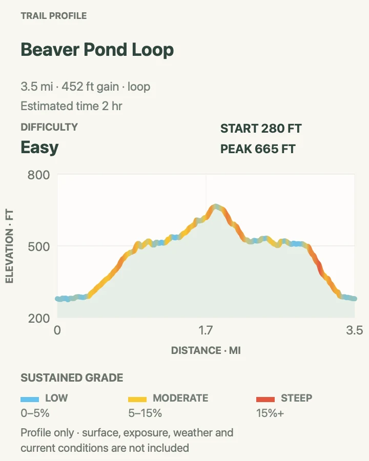
Tanalian Falls
- Distance
- About 4 miles by NPS; roughly 4.4 miles on the reviewed out-and-back
- Elevation gain
- 680 feet
- Time
- 2 hr 30 min
- Difficulty
- Moderate
- Route type
- out-and-back
- Parking
- Begin at the Tanalian Trails entrance near Port Alsworth's southern airstrip and follow the signed falls route.
- Best time
- Summer, after checking trail and aircraft conditions in Port Alsworth.
- Pets
- Leashed pets are allowed, though NPS recommends not bringing them into this wildlife-rich country.
The trail climbs through birch groves and spruce-covered slopes before reaching an open view over Lake Clark. Past that view, the sound of Tanalian Falls arrives before the water does. Glacial water drops about 30 feet over ancient lava into a cold, fast channel.
Mist and polished rock make the immediate falls area a poor place for shortcuts. Stay on durable tread and keep well back from the lip and current. The return repeats the direct trail, or an experienced group can use the Beaver Pond connector if that plan was confirmed on the current park map.
What helps on this route
- Protect a camera or phone before entering the spray zone; the falls can be far wetter than the forest approach.
- Speak up near the waterfall because its noise can hide both hikers and bears around a bend.
Terrain and access: Forest climb, roots and dirt, open lake views, cool waterfall mist, slick rock near fast glacial water, and about 680 feet of ascent on the reviewed route.

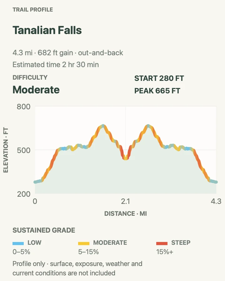
Kontrashibuna Lake via Tanalian Falls
- Distance
- About 5.5 miles by NPS; roughly 6.6 miles on the reviewed out-and-back
- Elevation gain
- 930 feet
- Time
- 3 hr 30 min
- Difficulty
- Moderate
- Route type
- out-and-back
- Parking
- Use the same walk-in Tanalian trailhead, pass Tanalian Falls, and continue on the signed lake trail.
- Best time
- A settled summer half-day with enough time for both the falls and lake shore.
- Pets
- Keep pets leashed at all times; consider the aircraft, bears, and remote turnaround before bringing one.
Beyond Tanalian Falls, the trail enters designated wilderness and continues to Kontrashibuna Lake. The change is noticeable: fewer short-stay walkers, a longer stretch between town and shelter, and a lake hemmed by mountains rather than a developed viewpoint.
The maintained day hike ends at the lake outlet. Shoreline travel beyond it and the Low Pass Route are backcountry propositions with different navigation and overnight consequences. Enjoy the shore, keep food controlled, and turn around at the mapped destination rather than extending the day because a faint line continues.
What helps on this route
- Set the turnaround from the aircraft check-in time, not from how close the lake appears on a small map.
- Carry a bear-resistant container if food will leave your immediate control; loaners may be available at the visitor center.
Terrain and access: Maintained forest trail past Tanalian Falls, roots, wilderness lake shore, bear habitat, limited communications, and roughly 930 feet of climbing on the reviewed line.

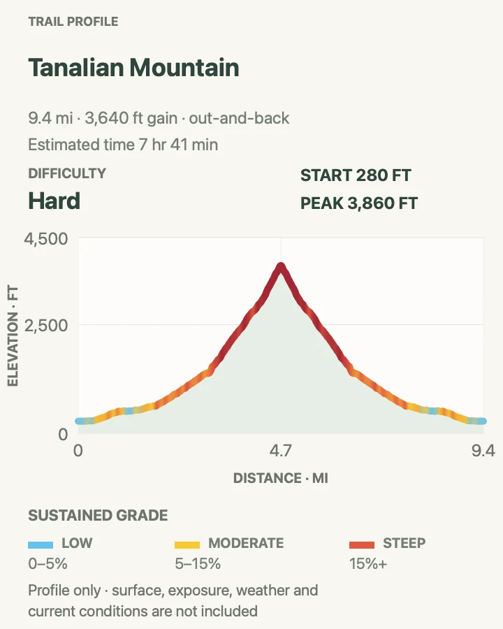
Tanalian Mountain
- Distance
- 8.6 miles by NPS; roughly 9.6 miles on the reviewed out-and-back
- Elevation gain
- 3,640 feet
- Time
- 7 hr 41 min
- Difficulty
- Hard
- Route type
- out-and-back
- Parking
- Start at the Tanalian Trails entrance and use the signed mountain branch from the falls route.
- Best time
- An early summer start with a clear mountain forecast and a generous flight margin.
- Pets
- A leashed pet is legally possible, but the steep climb, wildlife, exposure, and aircraft logistics make leaving it behind the sounder choice.
Tanalian Mountain shares the lower forest approach, then turns upward in earnest. Birch and spruce give way to alder and willow, followed by open tundra and rock. NPS calls the hike steep and rigorous, recommends at least eight hours, and points hikers toward a USGS benchmark near the summit.
The reviewed line gains about 3,640 feet. That is a different undertaking from the falls even though both begin at the same trailhead. Cloud can remove the summit view and make the open upper section harder to follow; high wind can make the final ridge an unnecessary gamble. Turning around below the top still leaves a substantial climb and good views over Lake Clark.
Carry enough food and water for the whole day, plus insulation and rain protection. Start early enough that an aircraft delay is the only schedule surprise, not a missed flight caused by an optimistic descent estimate.
What helps on this route
- Allow at least the park's eight-hour estimate, then add town walking and runway-crossing time.
- Make the final go-or-turn decision before reaching exposed terrain; descending wet rock or tundra in cloud is slower than the climb suggests.
Terrain and access: Steep forest, alder and willow, sustained climbing, alpine tundra, exposed rock, wind and cloud, and about 3,640 feet of ascent on the reviewed route.

Official planning sources
Trail access and safety details were checked against these National Park Service pages. The maps and profiles use the reviewed route geometry stored with this guide.
- NPS: Current Lake Clark alerts and conditions
- NPS: Lake Clark maintained day hikes and official distances
- NPS: Port Alsworth access, active runways, and visitor center
- NPS: Kontrashibuna Lake and the end of maintained tread
- NPS: Lake Clark bear safety and food storage
- NPS: Lake Clark pet rules
- NPS: Camping and backpacking guidance
- NPS: Tanalian Trails handout
Map data © OpenStreetMap contributors. Trail geometry and planning details include National Park Service public information.