8 Best Hikes in Everglades National Park
Eight Everglades walks for sawgrass wildlife, hardwood hammocks, Florida Bay, and pine rockland, with reviewed maps, flatland profiles, and live park alerts.
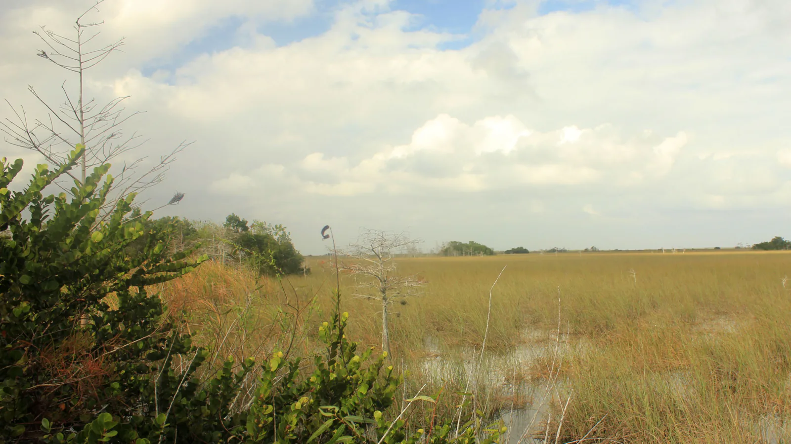
Everglades hiking is an exercise in looking across a few feet of elevation instead of climbing thousands. A shallow rise can hold pine rockland; a slightly wetter basin becomes sawgrass slough; a tree island lifts a tropical hardwood hammock above the water. The best walks make those small changes legible.
These eight routes cover Royal Palm, the main park road, Flamingo, Long Pine Key, and Shark Valley. Anhinga is the signature wildlife walk, but it is not allowed to swallow the list. A boardwalk through mahogany, an open sawgrass overlook, a Florida Bay shoreline, and longer unmaintained tracks show a much larger park.
In late August 2026, the named hiking districts below remain open while the East Everglades Day Use Area is closed for construction. Several longer trails are passable but intentionally not maintained because work could harm endangered-species habitat. That means vegetation, mud, and standing water are expected conditions, not proof that a trail has been abandoned.
What changes a hiking day here
Dry season is the walking season
December through April usually brings lower humidity, fewer mosquitoes, and concentrated wildlife around remaining water. Summer can mean severe insects, heat, thunderstorms, flooded tread, and hurricane-related closures.
Flat does not mean effortless
Sun, heat, saturated ground, and biting insects determine difficulty here. Carry water, repellent, sunscreen, and rain protection. Long sleeves and loose trousers often work better than repeatedly applying chemicals to every exposed area.
Wildlife owns the right of way
Never feed, touch, or step around an alligator at close range. Back away and wait or turn around. Keep hands inside boardwalk rails, supervise children, and treat every canal edge as active habitat.
The profile is supposed to look flat
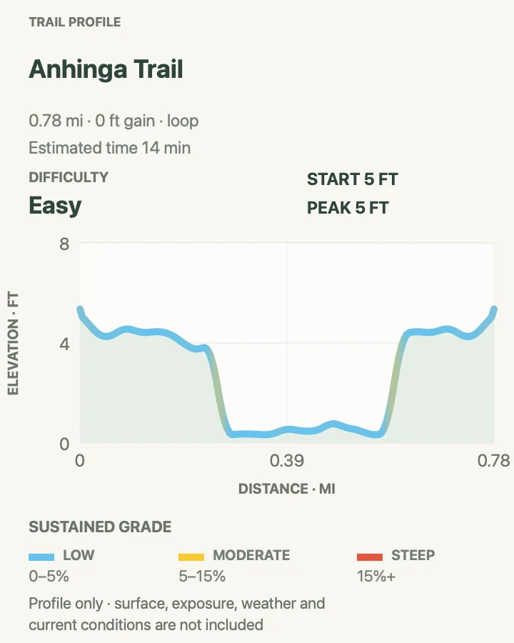
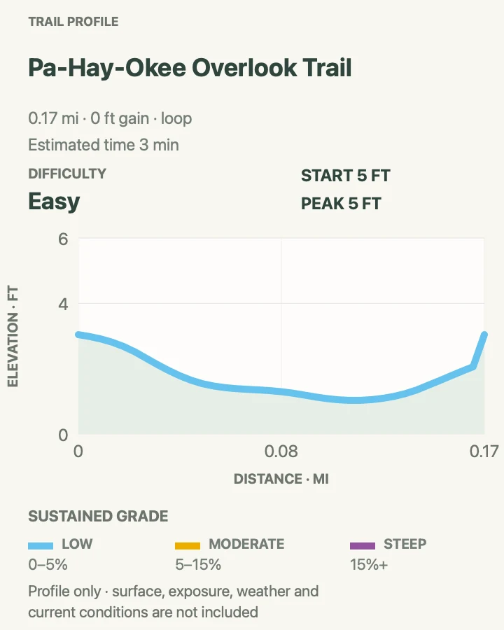
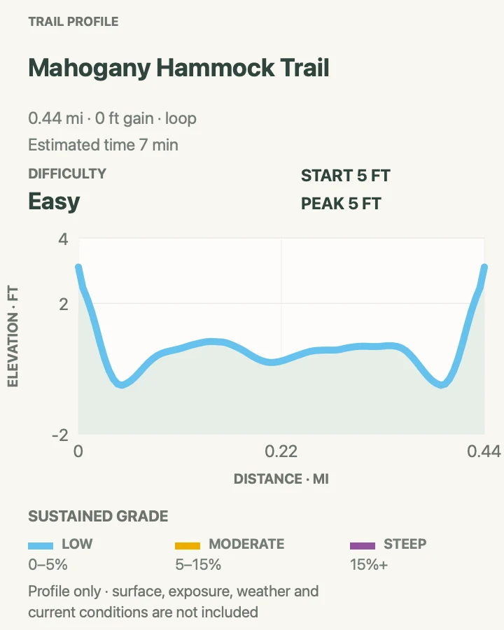
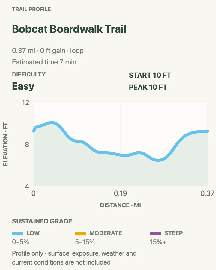
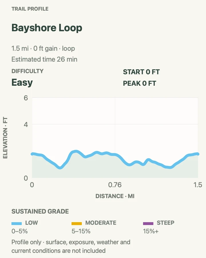
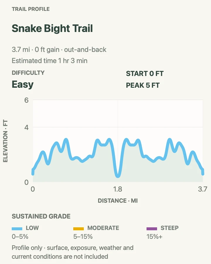
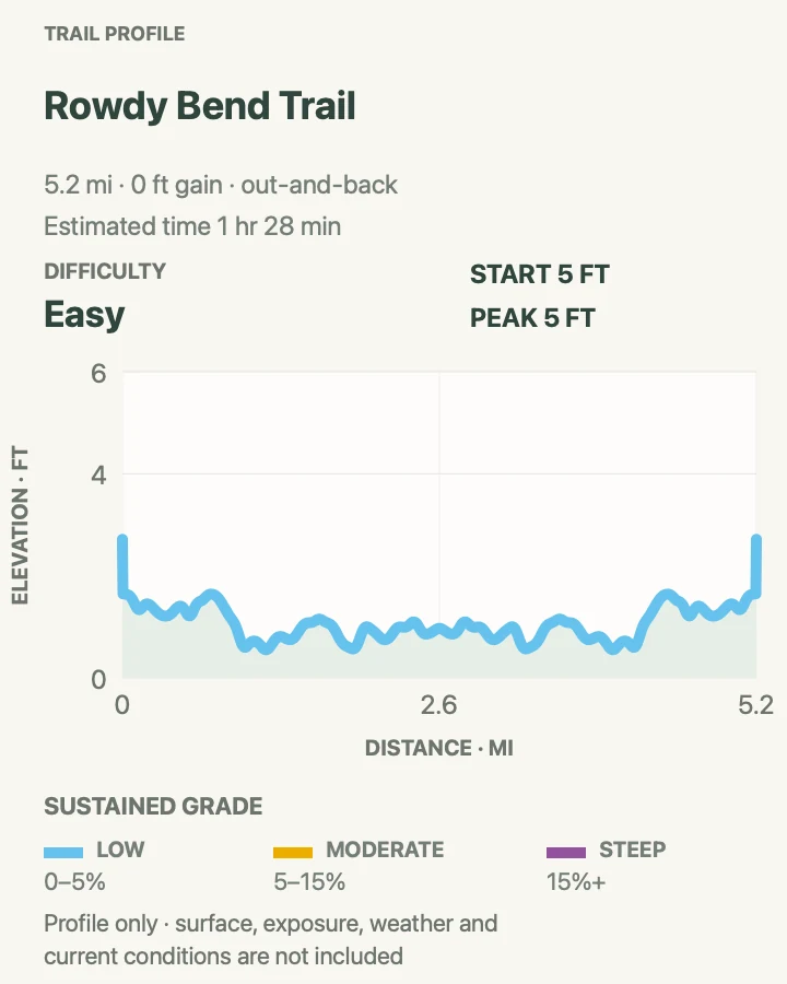
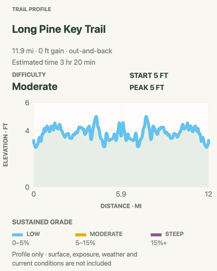
Everglades elevation profiles show only tiny changes, sometimes just a few feet. Use them to understand distance and surface transitions; they do not convert a wetland walk into a hill-climbing exercise.
| Trail | Distance | Time | Difficulty | Best for |
|---|---|---|---|---|
| Anhinga Trail via the Royal Palm Connector | 0.8 mi | 14 min | Easy | The park's most reliable short wildlife walk |
| Pa-Hay-Okee Overlook | 0.2 mi | 3 min | Easy | Understanding the scale of the River of Grass |
| Mahogany Hammock Trail | 0.4 mi | 7 min | Easy | A tropical hardwood tree island and dense shade |
| Bobcat Boardwalk at Shark Valley | 0.4 mi | 7 min | Easy | A short Shark Valley walk through slough and hammock |
| Bayshore Loop at Flamingo | 1.5 mi | 26 min | Easy | Florida Bay views and coastal birding near Flamingo |
| Snake Bight Trail | 3.7 mi | 1 hr 3 min | Easy | A straight forest corridor to a Florida Bay boardwalk |
| Rowdy Bend Trail | 5.2 mi | 1 hr 28 min | Easy | Woodland birds and a longer quiet walk near Flamingo |
| Long Pine Key to Pine Glades Lake | 11.8 mi | 3 hr 20 min | Moderate | A substantial pine-rockland walk with a lake turnaround |
Anhinga Trail via the Royal Palm Connector
- Distance
- 0.8 mi
- Elevation gain
- 0 feet
- Time
- 14 min
- Difficulty
- Easy
- Route type
- loop
- Parking
- Park at Royal Palm, four miles from the Homestead entrance. Follow Anhinga signs from the shared Gumbo Limbo approach.
- Best time
- A cool dry-season morning, when lower water concentrates birds and alligators along Taylor Slough.
- Pets
- Pets are not allowed on park trails. Trained service animals are allowed.
Anhinga crosses Taylor Slough on pavement and boardwalk, passing open sawgrass, deeper pools, and low roosting perches. Alligators, turtles, anhingas, herons, and purple gallinules can appear within one unhurried circuit.
The preserved 0.8-mile route includes the short Royal Palm connector beside Gumbo Limbo, which is why that name appears at the map's start. Stay on the built surface, leave animals a wide corridor, and never lean over a rail for a closer photograph.
What helps on this route
- Walk slowly and scan shaded water beneath the boardwalk before looking across the prairie.
- Protect vehicle trim and loose equipment from black vultures according to current parking-lot guidance.
Terrain and access: Paved path and boardwalk, level grade, open wetland, shared Royal Palm connector, intense sun, and frequent wildlife close to the route.

Pa-Hay-Okee Overlook
- Distance
- 0.2 mi
- Elevation gain
- 0 feet
- Time
- 3 min
- Difficulty
- Easy
- Route type
- loop
- Parking
- Use the signed Pa-Hay-Okee pullout along the main park road and remain within the marked parking area.
- Best time
- Late afternoon outside thunderstorm weather, when low light reveals channels in the sawgrass.
- Pets
- Pets are not allowed on park trails. Trained service animals are allowed.
A short raised boardwalk leads to an observation platform above an apparently endless sawgrass plain. The walk is tiny, but the view explains the slow sheet flow and subtle topography better than a windshield stop.
The boardwalk is accessible and currently open. Lightning is the larger concern in this exposed setting; return to the vehicle as soon as thunder is heard rather than waiting to watch a storm cross the prairie.
What helps on this route
- Bring binoculars for distant wading birds and raptors.
- Combine the stop with Mahogany Hammock instead of racing through every roadside boardwalk.
Terrain and access: Short elevated boardwalk, accessible observation deck, fully exposed sawgrass vista, no climbing, and lightning exposure.

Mahogany Hammock Trail
- Distance
- 0.4 mi
- Elevation gain
- 0 feet
- Time
- 7 min
- Difficulty
- Easy
- Route type
- loop
- Parking
- Turn onto the signed Mahogany Hammock spur about twenty miles from the Homestead entrance and use the developed lot.
- Best time
- Morning for birds or late afternoon for cooler air beneath the canopy.
- Pets
- Pets are not allowed on park trails. Trained service animals are allowed.
The half-mile boardwalk enters a hardwood hammock of gumbo limbo, air plants, royal palms, and an exceptionally large living mahogany. The shift from open marsh to dense canopy happens within a few steps.
Shade makes the air feel cooler but often increases mosquitoes. The boards can remain slick after rain, and branches hide wildlife at close range. Keep moving calmly and give snakes or other animals time to leave the path.
What helps on this route
- Look upward for epiphytes as well as down for roots and reptiles.
- Use repellent before entering rather than stopping on the narrow boardwalk to apply it.
Terrain and access: Accessible boardwalk, dense tropical canopy, damp and sometimes slick boards, mosquitoes, tight sightlines, and level ground.

Bobcat Boardwalk at Shark Valley
- Distance
- 0.4 mi
- Elevation gain
- 0 feet
- Time
- 7 min
- Difficulty
- Easy
- Route type
- loop
- Parking
- Use the Shark Valley lot off US 41. Arrive before 10 a.m.; parking can become one-car-in, one-car-out at midday.
- Best time
- Cool dry-season morning before tram and bicycle traffic builds.
- Pets
- Pets are not allowed on park trails. Trained service animals are allowed.
Bobcat Boardwalk leaves the busy Shark Valley tram road for sawgrass slough and tropical hardwood forest. It is the walking-sized alternative when a fifteen-mile tower loop is too much and a tram tour is not the plan.
The route is accessible and bicycles are not permitted on the boardwalk. Shark Valley has no reliable rideshare return, and parking queues can be long. Arrange transport before arrival rather than discovering the problem after the gates close.
What helps on this route
- Use the boardwalk before a tram ride; wildlife activity and parking are both usually better early.
- Pets are not permitted beyond the parking lot.
Terrain and access: Level accessible boardwalk, sawgrass slough, hardwood hammock, busy visitor-center approach, shade patches, and wildlife near the trail.

Bayshore Loop at Flamingo
- Distance
- 1.5 mi
- Elevation gain
- 0 feet
- Time
- 26 min
- Difficulty
- Easy
- Route type
- loop
- Parking
- Park in the Flamingo visitor and marina area, then follow current signs toward the Bayshore path.
- Best time
- Dry-season morning or evening, with low wind and manageable insects.
- Pets
- Pets are not allowed on park trails. Trained service animals are allowed.
Bayshore traces the edge of Florida Bay through buttonwood and open coastal ground. The route feels different from every inland boardwalk: salt air, mudflat views, and mangrove shore replace sawgrass and cypress.
Storm tides and vegetation can blur the tread. Mud, standing water, and mosquitoes vary by week. Confirm the route with Flamingo staff and turn around if water or shoreline erosion makes the loop uncertain.
What helps on this route
- Carry binoculars and check the tide if birding is the main purpose.
- Do not step onto exposed mudflat; footing and sensitive habitat are both poor.
Terrain and access: Coastal path, buttonwood, mangrove edge, mud, standing water, sun, mosquitoes, and hurricane-sensitive shoreline.

Snake Bight Trail
- Distance
- 3.7 mi
- Elevation gain
- 0 feet
- Time
- 1 hr 3 min
- Difficulty
- Easy
- Route type
- out-and-back
- Parking
- Use the signed pullout on the main park road north of Flamingo without blocking the gate or road shoulder.
- Best time
- Cool dry-season morning timed near high tide for better birding at the bay.
- Pets
- Pets are not allowed on park trails. Trained service animals are allowed.
Snake Bight follows an old road through tropical forest to a short boardwalk over Florida Bay. A bight is a bay within a bay; the name does not promise more snakes than elsewhere in the park.
The trail is passable but not maintained to protect endangered-plant habitat. Expect encroaching vegetation, mud, and mosquitoes. Bicycles may use the old road but not the terminal boardwalk, so hikers should listen for riders on the narrow corridor.
What helps on this route
- Check the tide before driving; low tide can put feeding birds far from the boardwalk.
- Wear long sleeves and eye protection when vegetation is high.
Terrain and access: Flat former road, overgrown vegetation, mud and water, dense insects, bicycle traffic, and short bay-edge boardwalk.

Rowdy Bend Trail
- Distance
- 5.2 mi
- Elevation gain
- 0 feet
- Time
- 1 hr 28 min
- Difficulty
- Easy
- Route type
- out-and-back
- Parking
- Use the legal roadside trail access near Flamingo and keep the gate and travel lane clear.
- Best time
- Dry-season morning after several rain-free days.
- Pets
- Pets are not allowed on park trails. Trained service animals are allowed.
Rowdy Bend uses another old road, this time through buttonwood and hardwood habitat favored by woodland birds. Its value is quiet repetition rather than a single viewpoint.
Like Snake Bight, it remains open but is not maintained because the corridor overlaps sensitive habitat. High grass can hide holes and standing water, while mosquitoes can turn five flat miles into hard work. Turn around early if the surface deteriorates.
What helps on this route
- Use gaiters or trousers that can handle wet vegetation brushing both legs.
- Note the entrance carefully; a straight overgrown road looks less obvious on the return in flat light.
Terrain and access: Flat overgrown former road, buttonwood and hardwood cover, mud, standing water, hidden uneven ground, insects, and no services.

Long Pine Key to Pine Glades Lake
- Distance
- 11.8 mi
- Elevation gain
- 0 feet
- Time
- 3 hr 20 min
- Difficulty
- Moderate
- Route type
- out-and-back
- Parking
- Begin at the Long Pine Key trail access or a signed road crossing; park fully off the pavement without blocking gates.
- Best time
- Cool, dry winter morning with enough daylight for a long out-and-back.
- Pets
- Pets are not allowed on park trails. Trained service animals are allowed.
The old track runs west through pine rockland toward Pine Glades Lake, crossing open prairie and hardwood patches along the way. The mapped 11.8-mile out-and-back samples a trail network with more than twenty miles of possible connections.
The corridor is open but not maintained because it supports endangered butterflies and their host plants. Vegetation, branches, mud, and water can slow progress. Do not widen the track, cut plants, or assume bicycle time estimates apply on foot.
What helps on this route
- Set a firm turnaround time; flat terrain makes it easy to underestimate the return distance.
- Carry a paper park map and enough water for the full out-and-back.
Terrain and access: Flat dirt two-track, pine rockland, prairie, seasonal mud and water, encroaching plants, sun exposure, and numerous network junctions.

Official planning sources
Trail access and safety details were checked against these National Park Service pages. The maps and profiles use the reviewed route geometry stored with this guide.
- NPS: Current conditions and closures
- NPS: Hiking trail directory and maintenance status
- NPS: Pine Island and Royal Palm trails
- NPS: Anhinga Trail
- NPS: Mahogany Hammock Trail
- NPS: Bobcat Boardwalk
- NPS: Shark Valley access and parking
- NPS: Long Pine Key trails
- NPS: Bicycle and mixed-use trail rules
- NPS: Mobility and accessible trails
Map data © OpenStreetMap contributors. Trail geometry and planning details include National Park Service public information.